Google Launches AI-Powered Air View+
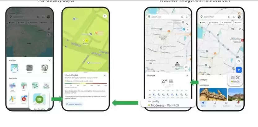
November 22, 2024 - In response to severe air pollution in Delhi-NCR and surrounding regions, Google has introduced a new AI-powered feature called Air View+. This tool will help users check the pollution levels in the air at streets and intersections across the country using Google Maps.
Real-Time Pollution Tracking
The Air View+ feature provides real-time, hyperlocal air quality information, giving users an accurate picture of pollution levels in their area.
Colour-Coded Pollution Levels
Google Maps will display pollution levels using a colour-coding system. Green indicates normal air quality, while dark red signals high pollution. This system is designed to make it easy for users to understand air quality at a glance.
Air Quality Index (AQI)
Google’s new feature will also show the Air Quality Index (AQI) on a scale from 0 to 500. The AQI will reflect the level of pollution in a specific area.
-
0-50: Good
-
51-100: Satisfactory
-
101-200: Moderate
-
201-300: Poor
-
301-400: Very Poor
-
401-500: Hazardous
This feature is available on both the Google Maps app and website, helping users stay informed about air quality in their local environment.
Source:Media Reports
To join us on Facebook Click Here and Subscribe to UdaipurTimes Broadcast channels on GoogleNews | Telegram | Signal


